About Bloor Homes
Bloor Homes is a family-owned private housebuilder with a reputation for quality, consistently achieving the highest five-star rating for customer satisfaction in the annual National Housebuilders Federation National New Homes Customer Satisfaction Survey. Over 97% of customers would recommend Bloor Homes to family and friends.
Find out more at: https://bloorhomes.com/
The site
The circa 15.7 hectare (ha) site comprises a single agricultural field located northwest of Pulley Lane and north of the A5, to the south of Shrewsbury. The site is bound to the north by Rea Brook and a tree belt that follows this watercourse. North of Rea Brook is an agricultural field which abuts Meole Brace, forming the settlement boundary of Shrewsbury. Immediately east of the site lies further existing residential development of Meole Brace. The southern boundary comprises the A5 dual carriageway. The west of the site tapers following the course of Rea Brook with agricultural fields and the Shrewsbury and Welshpool Railway beyond.
The site is currently predominantly used for arable agriculture, which is of relatively low biodiversity value. Existing higher value habitats on the field boundaries, such as the brook, mature trees and hedgerows, will be retained as much as possible and enhanced with additional landscape planting, with the majority of the site area being retained as public open space.
Existing public rights of way skirt the site on the eastern and western boundaries, while an informal claimed path follows the route of the brook along its southern bank. Existing paths will be retained and enhanced as part of the development proposals.
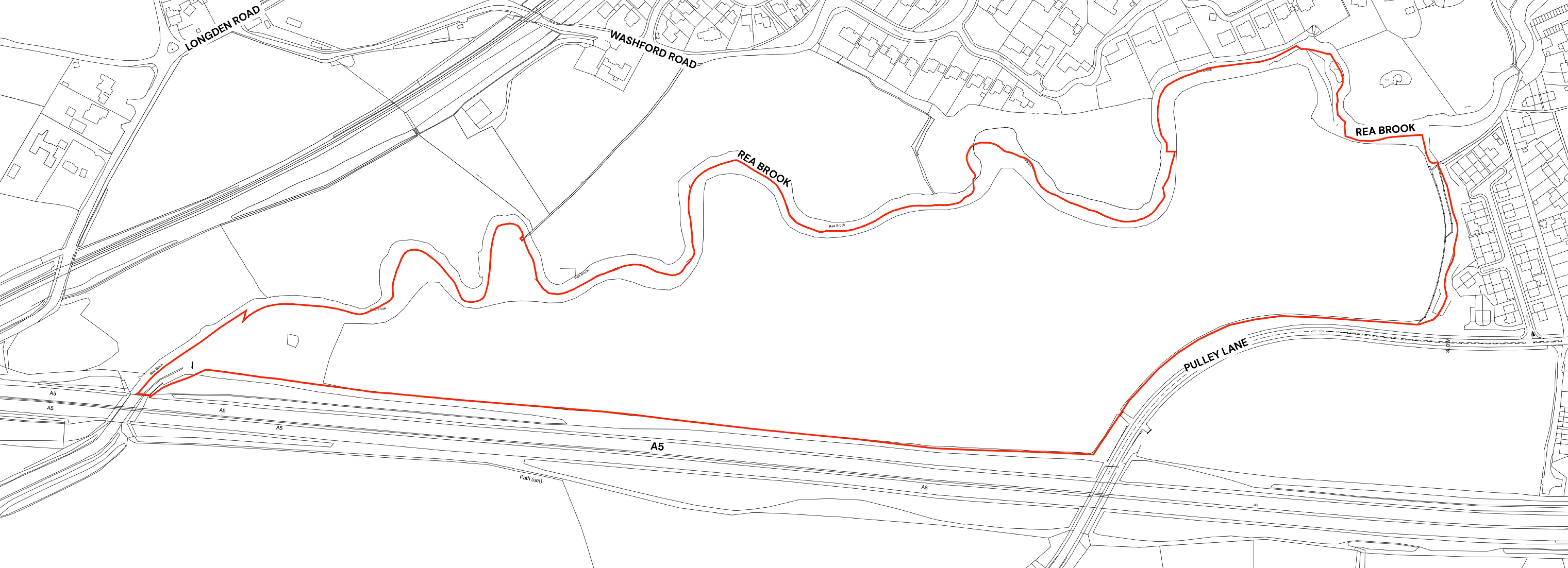
Site location plan - click to enlarge
Planning policy context
The site is located outside of the green belt and occupies a highly sustainable location adjacent to the south of the settlement boundary of Shrewsbury. As such, it was submitted via Shropshire Council’s latest Call for Sites as part of their emerging new Local Plan.
Draft Local Plan
Local planning authorities are required by Government to update their Local Plans every five years. The current adopted Local Plan for Shropshire is the Core Strategy which was adopted in 2011 and has therefore now fallen significantly out of date. Shropshire Council had been preparing a new Local Plan, however this was abandoned in July 2025 following issues arising from the Independent Examination. Following the withdrawal of the previous draft Plan, Shropshire Council is now preparing a new Local Plan for 2025-2045 which will guide future development. Formal preparation is expected to begin in January 2026, with evidence gathering currently underway. Alongside the preparation of the new Local Plan, it is essential that Shropshire Council can continue to demonstrate housing delivery.
Increased housing targets
Changes to the National Planning Policy Framework announced by the Government in late 2024 has nearly doubled the number of homes Shropshire Council will need to deliver from 1,070 to 2,025 homes per year. This has left Shropshire Council with a shortfall in housing land supply.
Five-year housing land supply
The NPPF also requires that local authorities such as Shropshire Council are able to demonstrate a five-year housing land supply. This is the amount of land that the Council must identify to ensure there are sufficient deliverable sites for residential development over the next five years. Shropshire Council currently cannot demonstrate a five-year supply of deliverable housing land.
Outline planning application
In light of the current position on housing, an outline planning application for the site is now being brought forward to contribute to meeting this housing delivery shortfall while delivering extensive open space and recreational infrastructure at a sustainable location adjacent to the existing settlement boundary of Shrewsbury. The development proposed by Bloor Homes will support Shropshire’s housing needs while contributing positively to the local community.
An outline planning application establishes the broad principles of development, such as access arrangements, illustrative concept layout, number of homes and general extent of development.
If outline planning consent is granted, a detailed planning application called a Reserved Matters planning application would be prepared. This would include more detail such as architecture, materials, detailed layout and landscaping, and would be subject to further consultation with the local community before being submitted for determination. Both outline and Reserved Matters planning applications are subject to Statutory Consultation carried out by the Local Planning Authority (Shropshire Council).
Site constraints and opportunities
How site features and landscape have shaped the proposed illustrative layout of the new neighbourhood.
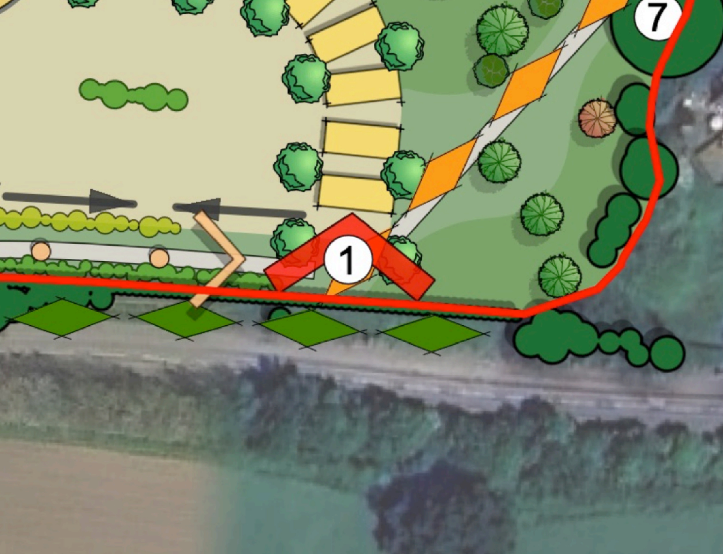
In preparing the concept layout for the site, the technical team appointed by Bloor Homes first of all considered the landscape, drainage features, topography and local context of the site. The accompanying plan shows some of the features and constraints that have informed the emerging outline proposals.
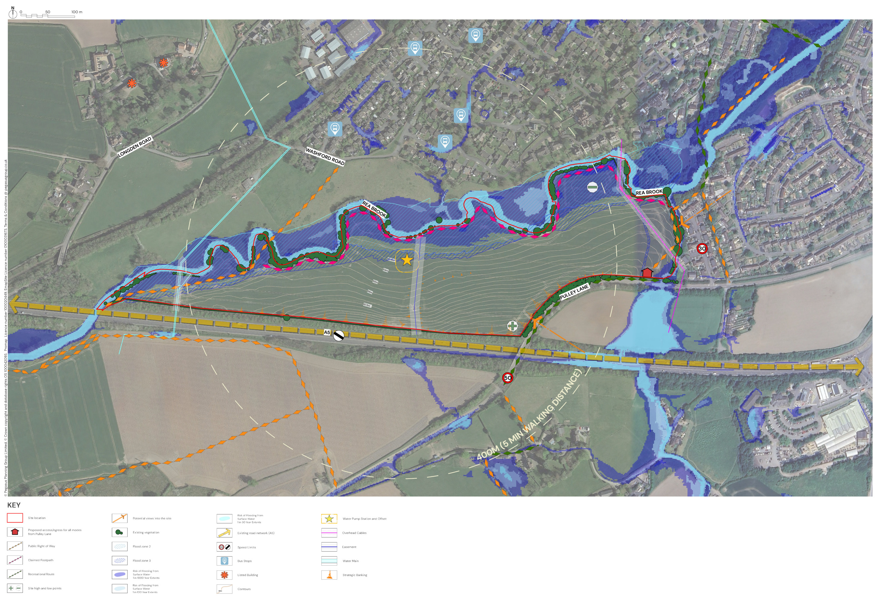
This plan shows analysis of some of the site features that have influenced the illustrative masterplan for the new neighbourhood - click to enlarge
The outline proposals
Bloor Homes is preparing an outline planning application for a landscape-led residential development at Pulley Lane, Shrewsbury, including:
- Up to 210 high-quality homes, including family homes and properties suitable for down-sizers.
- 20% of the new homes will be provided as affordable housing, providing opportunities for those on lower incomes and first-time buyers to secure a home of their own in the Shrewsbury area.
- A gas-free development with all homes built to be net zero carbon-ready, including air source heat pumps, solar panels, uprated insulation and EV charging infrastructure.
- More than half of the site area will be provided as attractively landscaped new public open space in a landscape-led approach to development, with the retention of existing trees and the majority of hedgerows, alongside extensive planting of new trees, a community orchard and areas for biodiversity.
- The open space proposals include the creation of Rea Brook Greenway – a proposed outdoor recreation and biodiversity resource that has the potential to act as an extension of the existing Rea Brook Valley Nature Reserve.
- Play areas for children as well as areas for natural play.
- Vehicular, cycle and pedestrian access directly from Pulley Lane.
- A network of new publicly accessible walking and cycling routes through the landscaped open spaces.
- Connectivity to existing public rights of way providing cycle and pedestrian access to surrounding area.
- A sustainable drainage system (SuDS) to manage surface water and create new habitat areas.
- Multi-million pound investment to support local infrastructure such as healthcare and education.
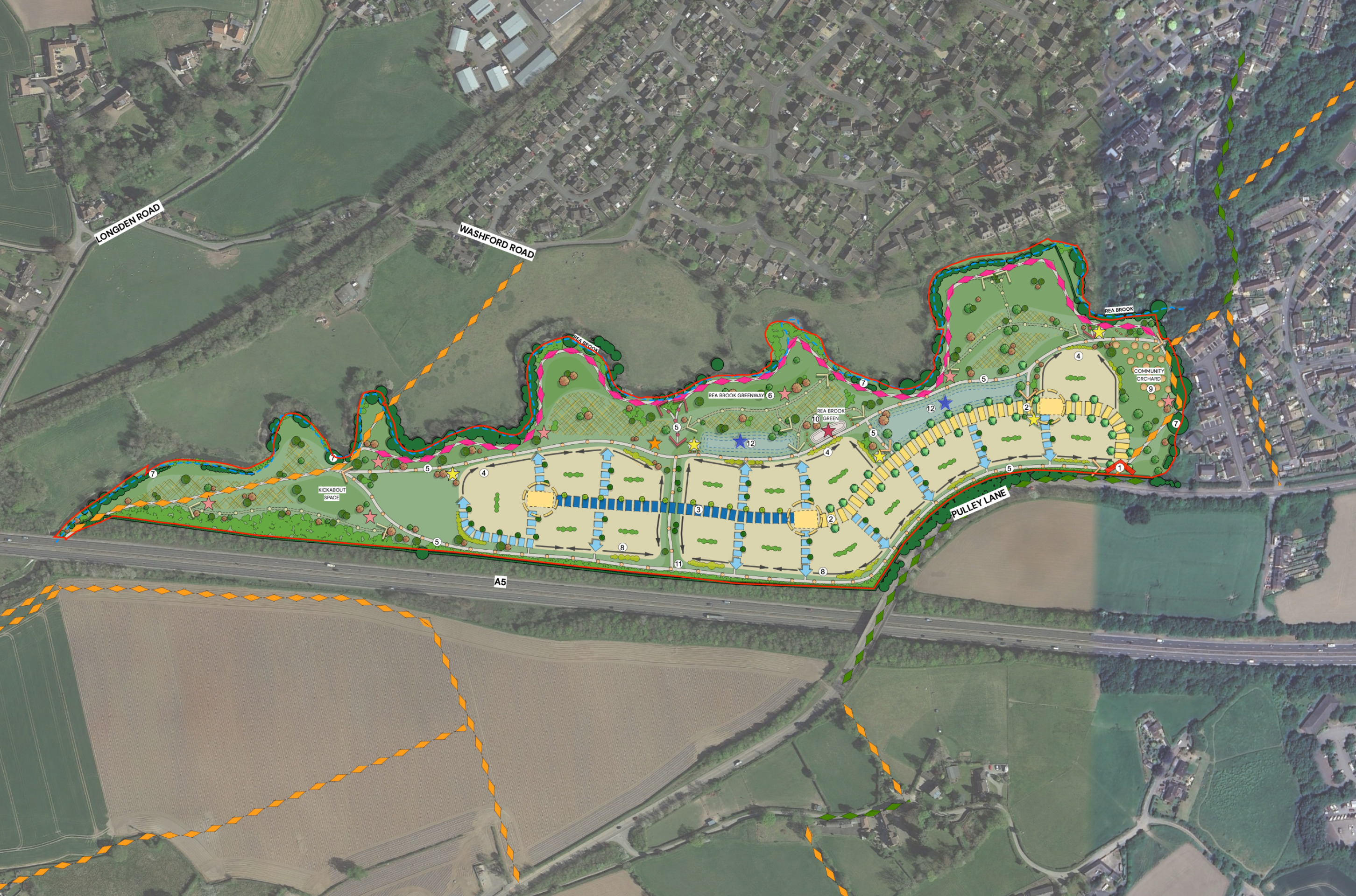
Illustrative concept masterplan of the proposed development (please note that this is subject to change in response to ongoing technical work and consultation feedback). Click to open interactive masterplan map.
New homes
House types
The planning application being prepared by Bloor Homes is an outline planning application. This type of planning application sets out the broad principles of development, such as maximum number of homes, an illustrative layout and site access arrangements. Should outline planning permission be received, finer details such as specific house types, detailed layout, architecture etc would be subject to a subsequent further planning application (called a Reserved Matters planning application). This would involve further consultation with the community.
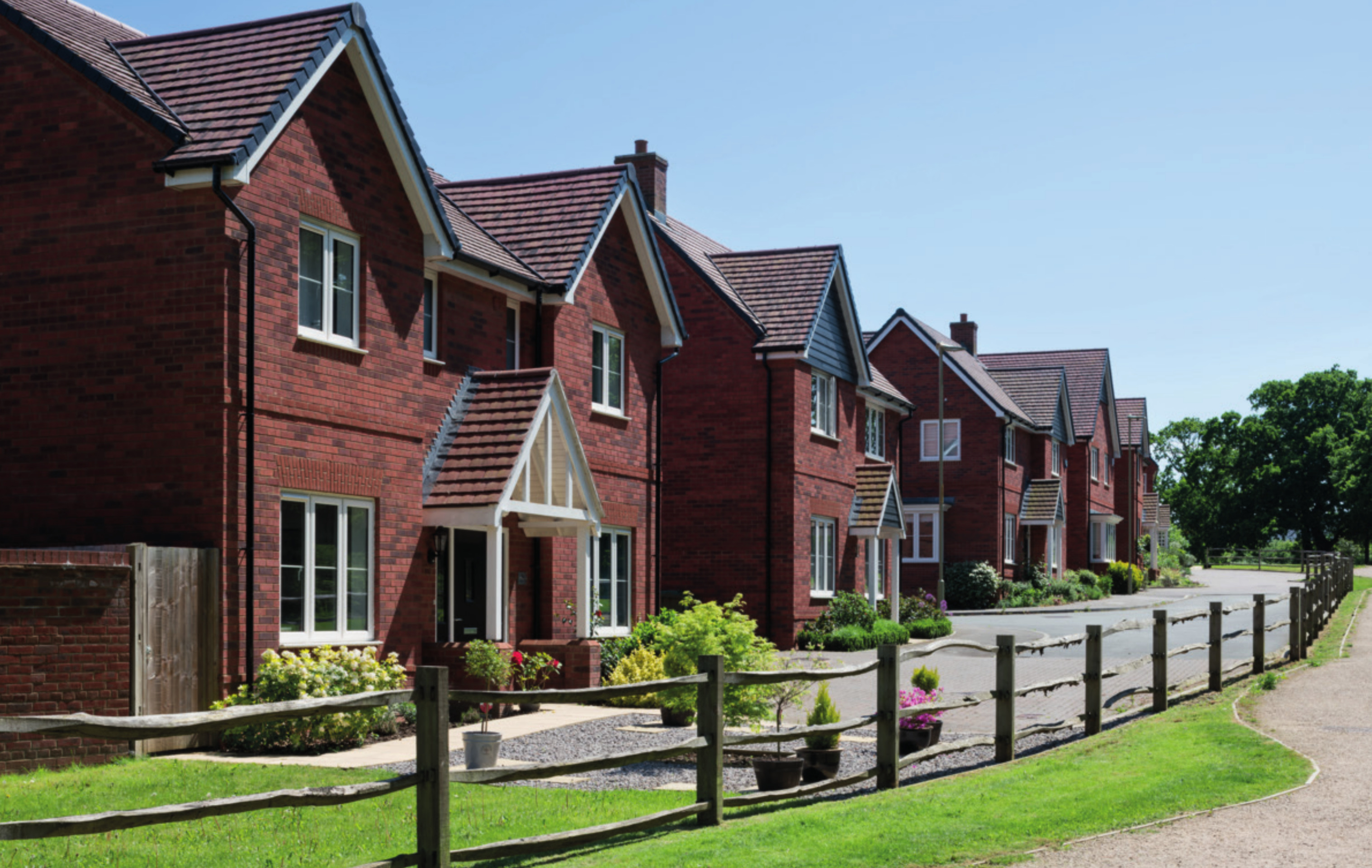
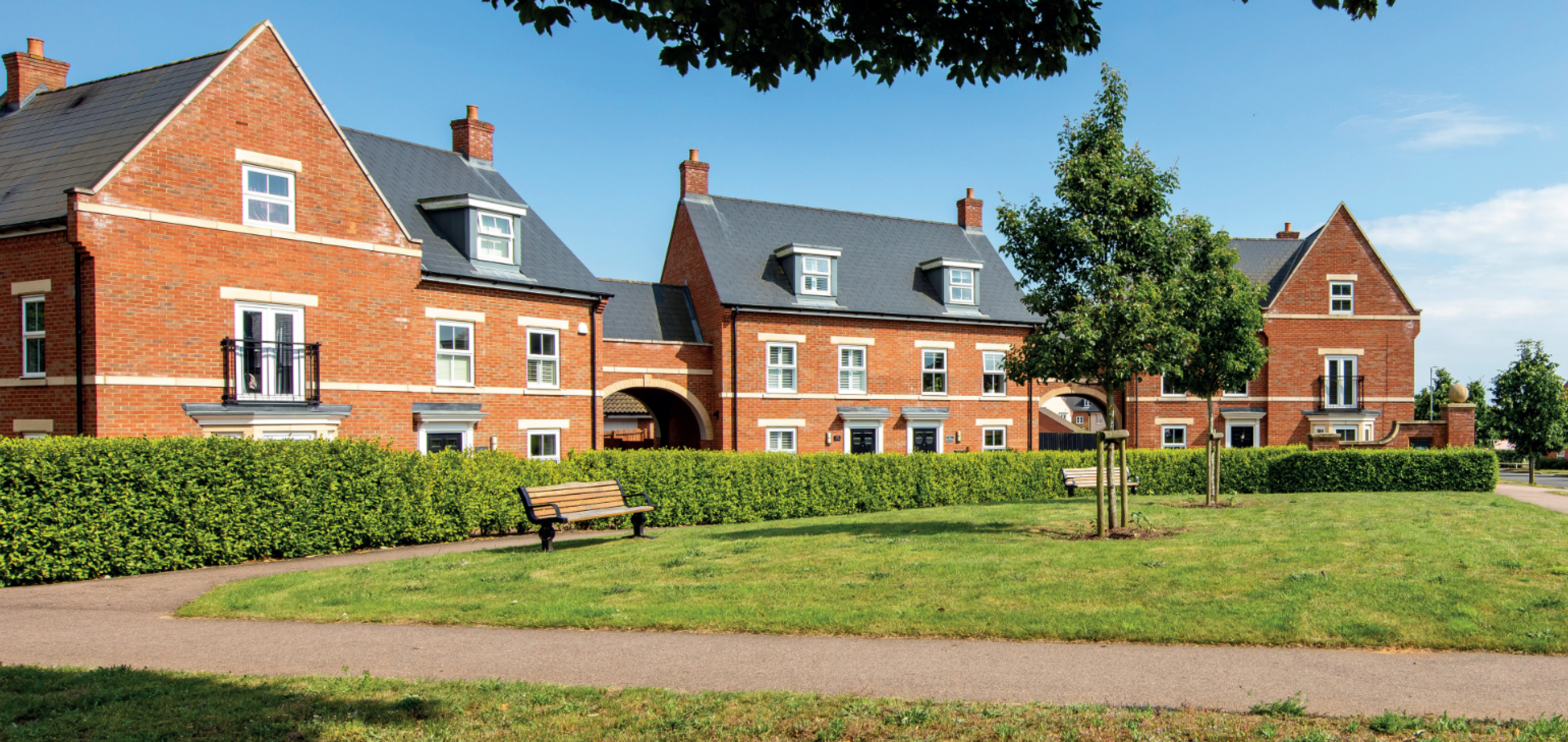
While house types would be determined at the Reserved Matters planning stage, we have provided imagery of existing Bloor Homes developments on this website to provide an idea of the types of high-quality homes we build.
Use the feedback questionnaire to tell us the types of homes you would like to see prioritised at Pulley Lane.
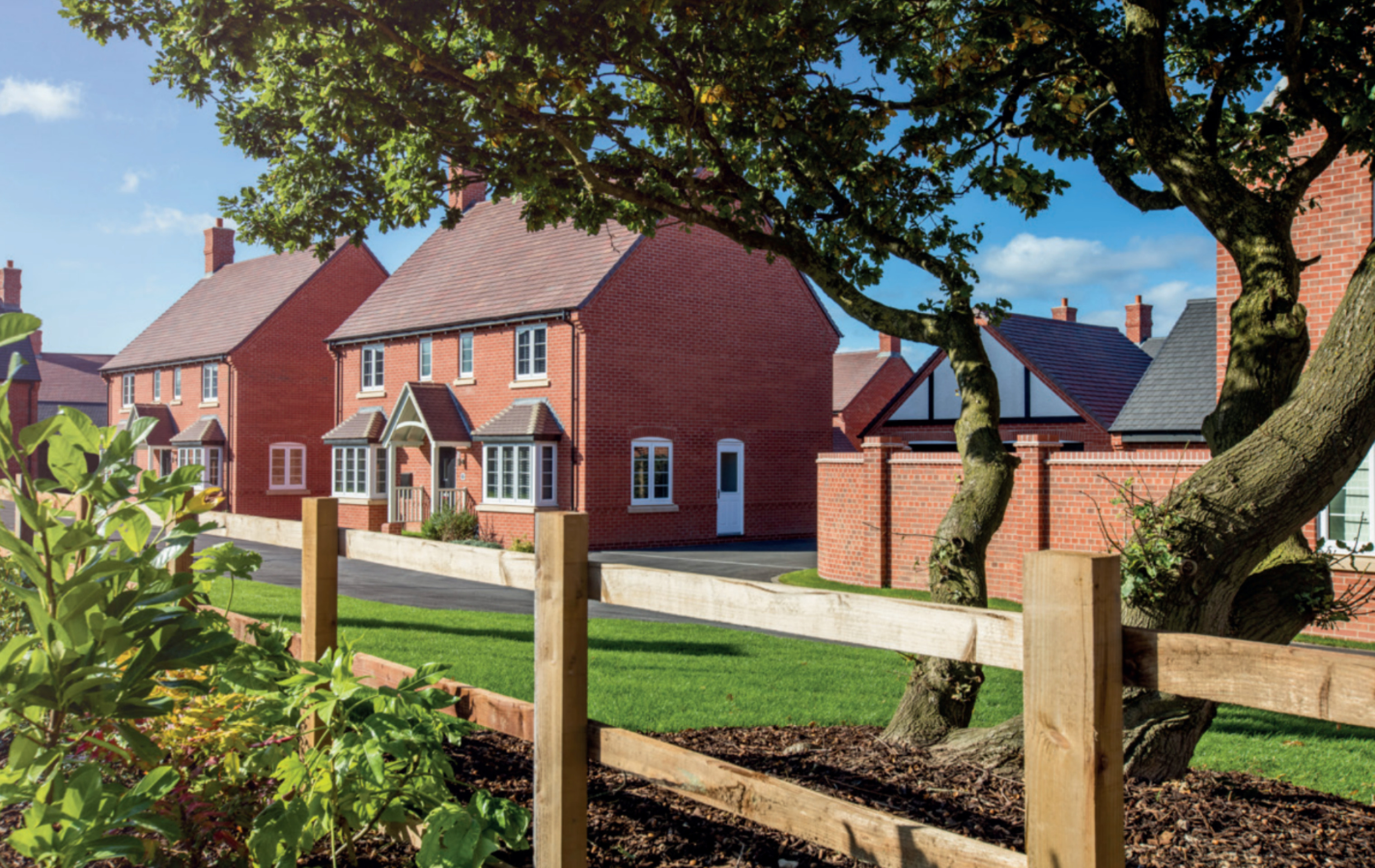
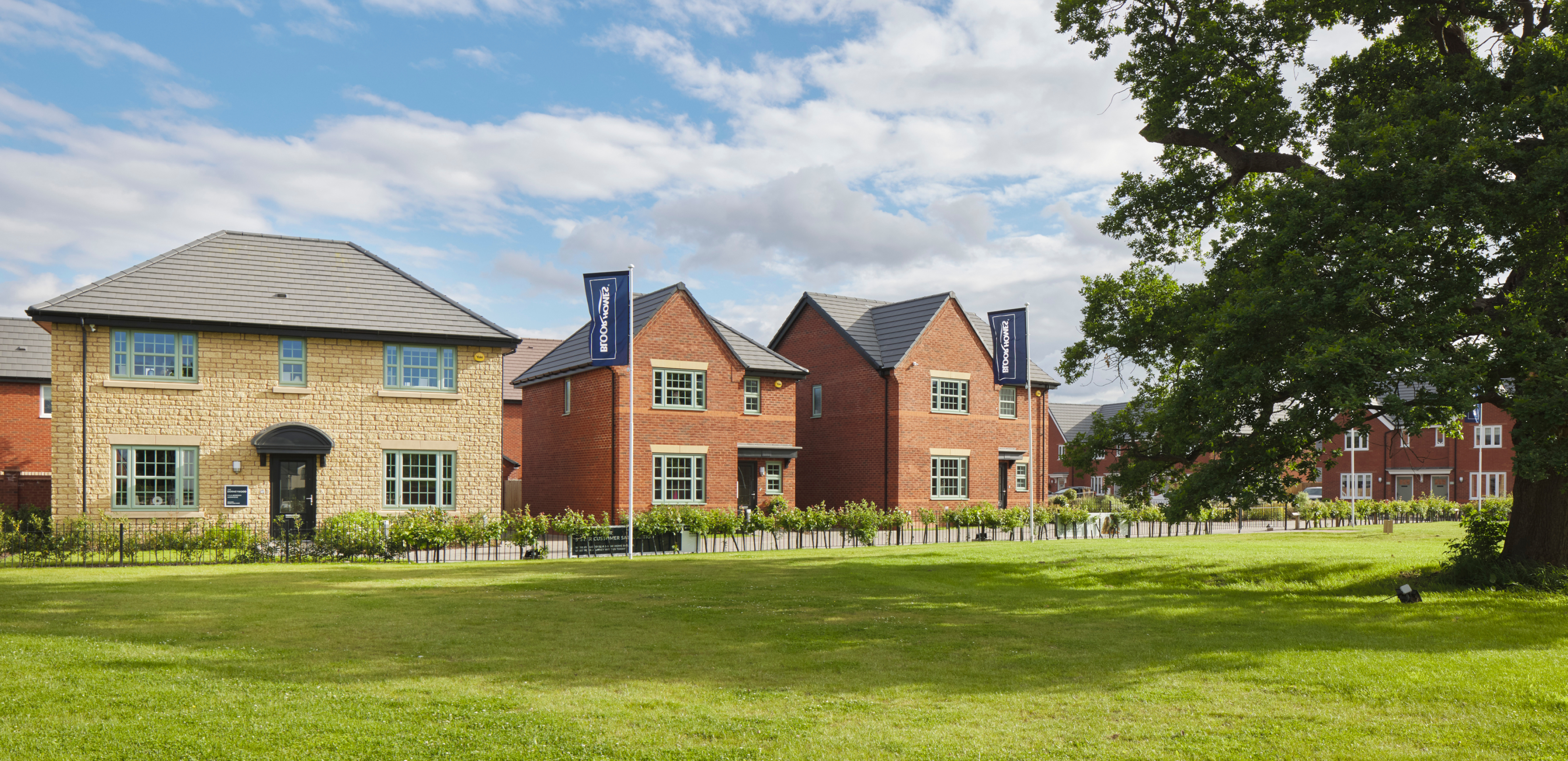
Examples of some recent Bloor Homes developments. Click to open a gallery of images.
Affordable homes
20% of the new homes would be classified as affordable homes in line with local policy requirements. This will provide opportunities for those on lower incomes with connections to the local area to secure a home of their own. Affordable housing is anticipated to be provided in a mix of affordable rent and shared ownership homes, however this will be determined in consultation with Shropshire Council’s Housing Team.
Sustainable homes
We want to deliver homes that are sustainable now and contribute to a cleaner, greener future.
We know that sustainability is hugely important to communities across the country. The new homes at Pulley Lane will be built to the Future Homes Standard, resulting in a neighbourhood of net zero carbon ready homes.
The development will be gas-free, with all homes provided with air source heat pumps as standard. PV cells (solar panels) will also be incorporated, which along with the use of the latest materials and technique to maximise insulation, air tightness and heat recovery, will create an uplift in energy efficiency of 75-80%. The new homes will incorporate sanitaryware and appliances that meet the highest water efficiency standards.
Electric vehicle (EV) charging points will be provided for all homes with on plot parking, together with access to communal EV charging points for the whole development.
To minimise the impact of construction, we always aim to procure materials from sustainable sources and recycle construction waste as far as is possible.

The development will be gas-free, with homes provided with air source heat pumps, solar panels and EV charging points as standard.
Investing in community infrastructure
A key consideration with a planning proposal such as this is to ensure that local services receive the investment they need to accommodate housing growth in the local area. The development will generate investment into local infrastructure such as healthcare and education, and this will be informed by consultation carried out by Shropshire Council with statutory bodies such as the local NHS Integrated Care Board and the local education team. Investment funding will be secured via Community Infrastructure Levy (CIL) payments or appropriate legal agreement between Bloor Homes and the Council.

The development will generate significant funding for key infrastructure such as healthcare and education, to be determined in consultation with bodies such as the NHS, local education authority, etc
Access and highways
A Transport Assessment will be submitted as part of the Outline Planning application. This will be published with the application documents and will provide a comprehensive study evaluating any potential traffic and transport impacts resulting from development.
Access
Vehicular access to this development is proposed via Pulley Lane. A pre-application consultation has been undertaken in line with best practice guidance with the Local Highways Authority and National Highways to agree a strategy for the forthcoming planning application and to ensure all required assessments are undertaken and a site access strategy agreed.
Wider network
Traffic surveys have been undertaken at junctions on the local road network to help inform the Transport Assessment which will form part of the outline planning application. This study will carry out an assessment of these junctions, known as a “Junction Capacity Assessment”, which models how the junctions perform currently and how they will perform in a future year scenario with the development in place. The methodology and parameters for this assessment have been agreed with the Local Highways Authority through the pre-application process set out above.
Vehicular, cycle and pedestrian access will be taken via a new junction with Pulley Lane. Click to enlarge.
Active travel
A network of new walking and cycling routes will be created within the development, which will tie into the existing 3m shared walk/cycleway on Pulley Lane. This will provide onward connections to amenities within Meole Brace area and the existing Park and Ride facility that provides a convenient service into the centre of Shrewsbury.
The application will also be supported by a Travel Plan, which will set out measures to encourage residents to use sustainable modes of transport like walking, cycling and public transport.
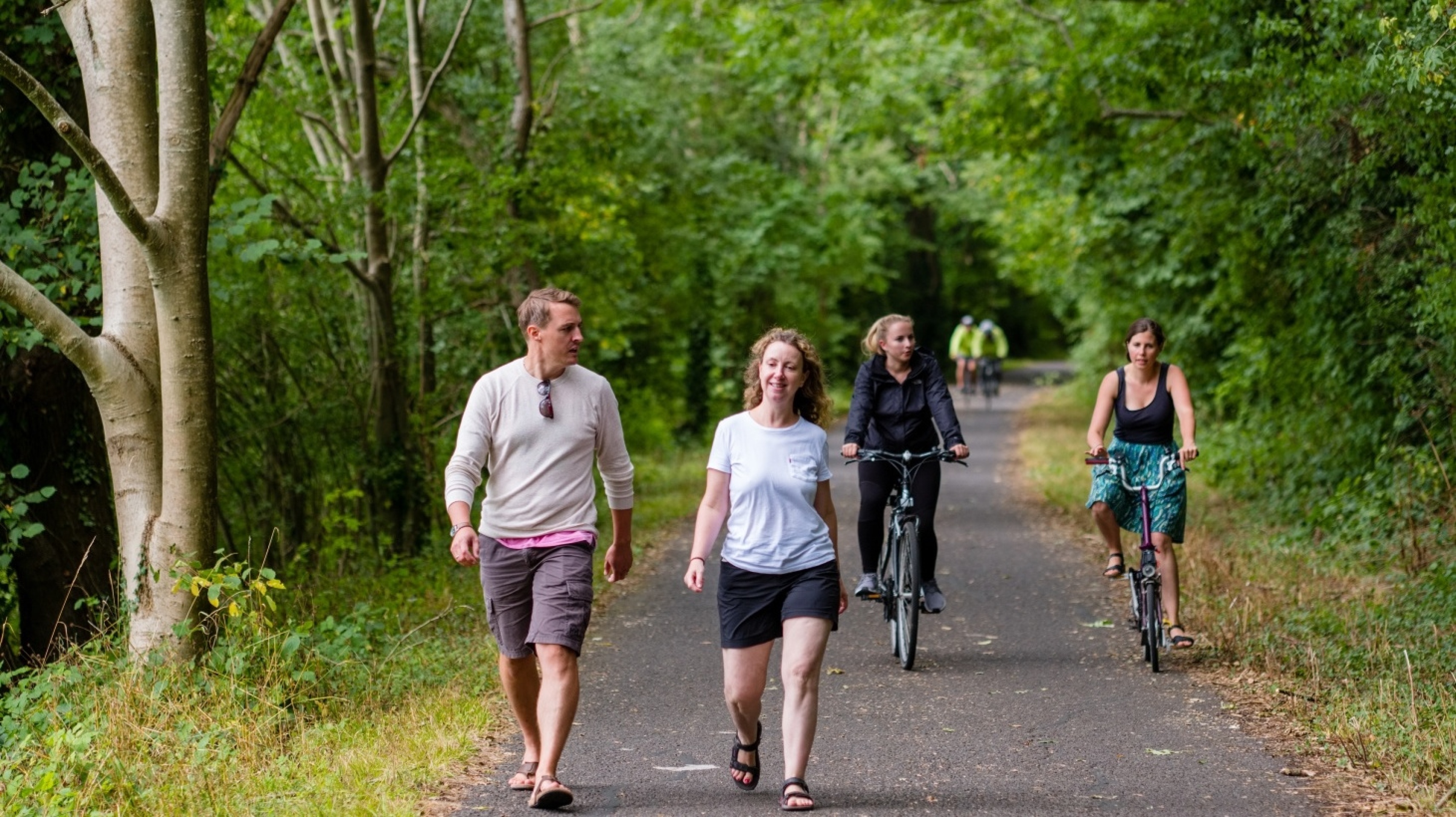
Extensive public open spaces within the development will provide opportunities for walking and cycling, with links to wider active travel connections.
Outdoor recreation
The proposed development will provide extensive high quality and attractively landscaped public open spaces, to create a healthy, active environment for residents and the wider community. Open spaces will surround the residential development, with a new common, Rea Brook Green featuring a children’s play area and areas to socialise outdoors. A network of walking and cycling route will pass through landscaped open spaces, including significant planting of new trees, a community orchard, informal areas of play and areas of natural play.
Along the southern bank of Rea Brook itself, will be an extensive area of public open space, Rea Brook Greenway. This will provide an outdoor recreation and biodiversity resource that has the potential to serve as an extension of the existing Rea Brook Valley Nature Reserve to the east of the site, and will include enhancements to the existing informal path along the banks of the brook, tree planting, and large areas of wildflower habitat enhancement.
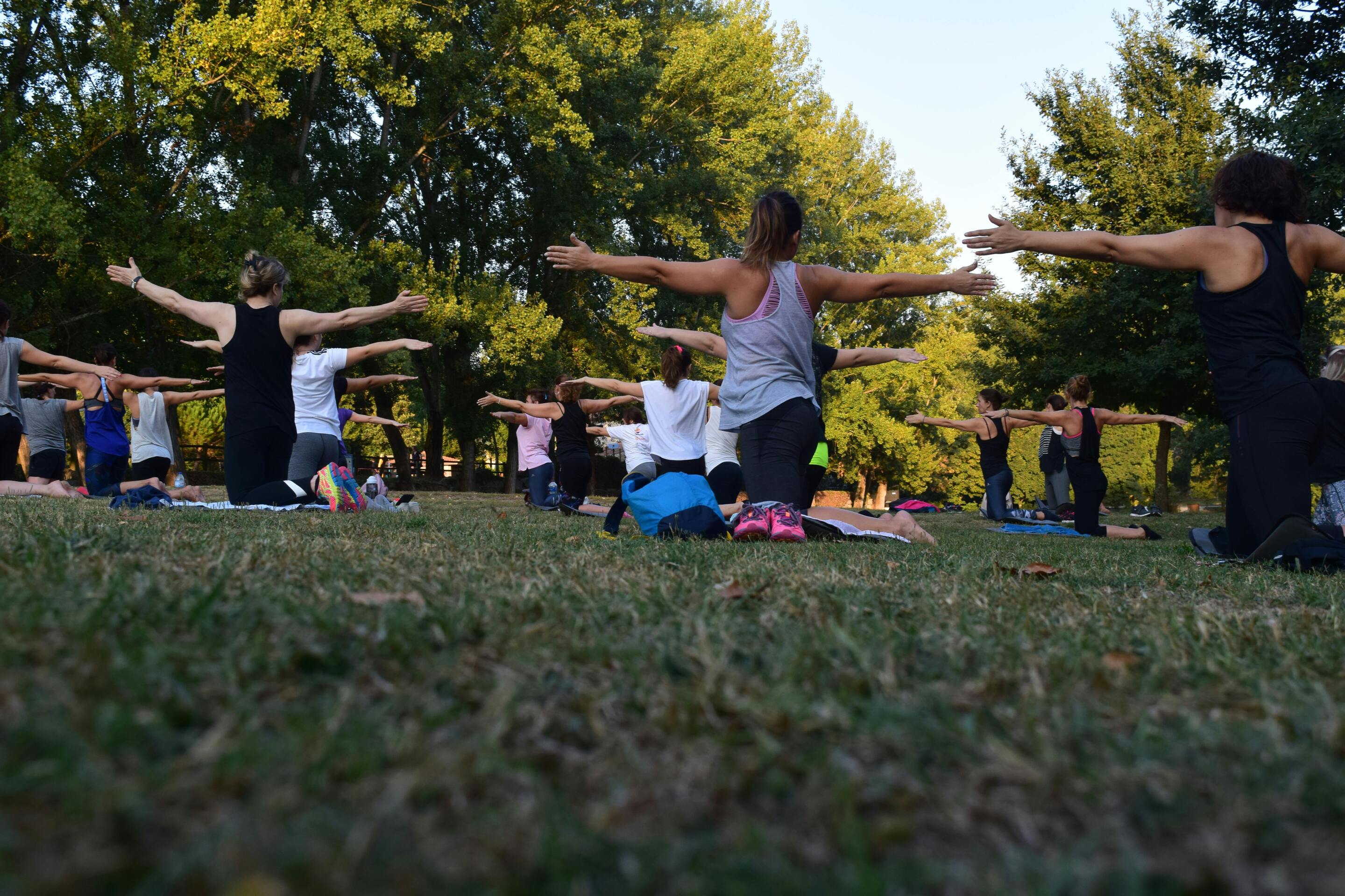
The development will feature high quality open space providing a range of outdoor recreational opportunities.
Ecology
We want to ensure that natural habitats are protected while we deliver new homes for people and families.
We are conscious of the ever-increasing importance of ensuring that development is sustainable, protecting and enhancing natural habitats and green infrastructure as much as possible whilst delivering much needed homes for people and families.
Local context
The site is not covered by any statutory designations with a single European designated site within 10km. The Rea Brook Valley Local Nature Reserve is located around 100m to the north-east of the site. The landscape strategy for the proposed development includes the creation of Rea Brook Greenway, an area of open space and habitat enhancement that could provide an extension of the nature reserve.
Three Local Wildlife Sites (LWS) are present within 2km of the Site with the closest, Radbrook - Mousecroft Lane LWS located around 780m north. There is no designated Ancient Woodland covering any part of the site or within 500m, and no trees on or adjacent to the site are listed on the Ancient Tree Inventory.

Site ecology
The site itself comprises an arable field of low ecological value. However, the field is bounded by hedgerows and mature trees forming higher value habitats which will be retained as much as possible.
The Rea Brook forms the northern boundary of the site, with parcels of grassland along the watercourse.
The scheme design will aim to retain and buffer existing features of higher ecological value wherever possible and aims to provide new habitat planting to enhance them. In addition, new habitats of value will be created in areas of open space present on-site including wildflower grassland meadows, native scrub, and species rich hedgerow planting, to maximise the on-site biodiversity value and deliver Biodiversity Net Gain.
Species
The site walkover and desk study has identified the potential for breeding birds, bats, reptiles, otter and water voles to be present on-site and further survey work is underway to determine the presence/absence of several protected and priority species and their usage of the site. To date evidence of otter has been recorded along the Rea Brook.
High value habitats such as hedgerows and the watercourse will be buffered from the development as much as possible to retain these features for foraging and nesting, and the scheme design allows for the creation of new green corridors with native species rich hedgerow and native scrub planting maintaining and improving the connectivity across the wider landscape.
Rea Brook Greenway
As set out above, the scheme will deliver an extensive area of publicly accessible open space and habitat enhancement along the southern banks of the Rea Brook. Known as Rea Brook Greenway, this has the potential to provide a western extension of the existing Rea Brook Valley Nature Reserve which is located to the northeast of the site.
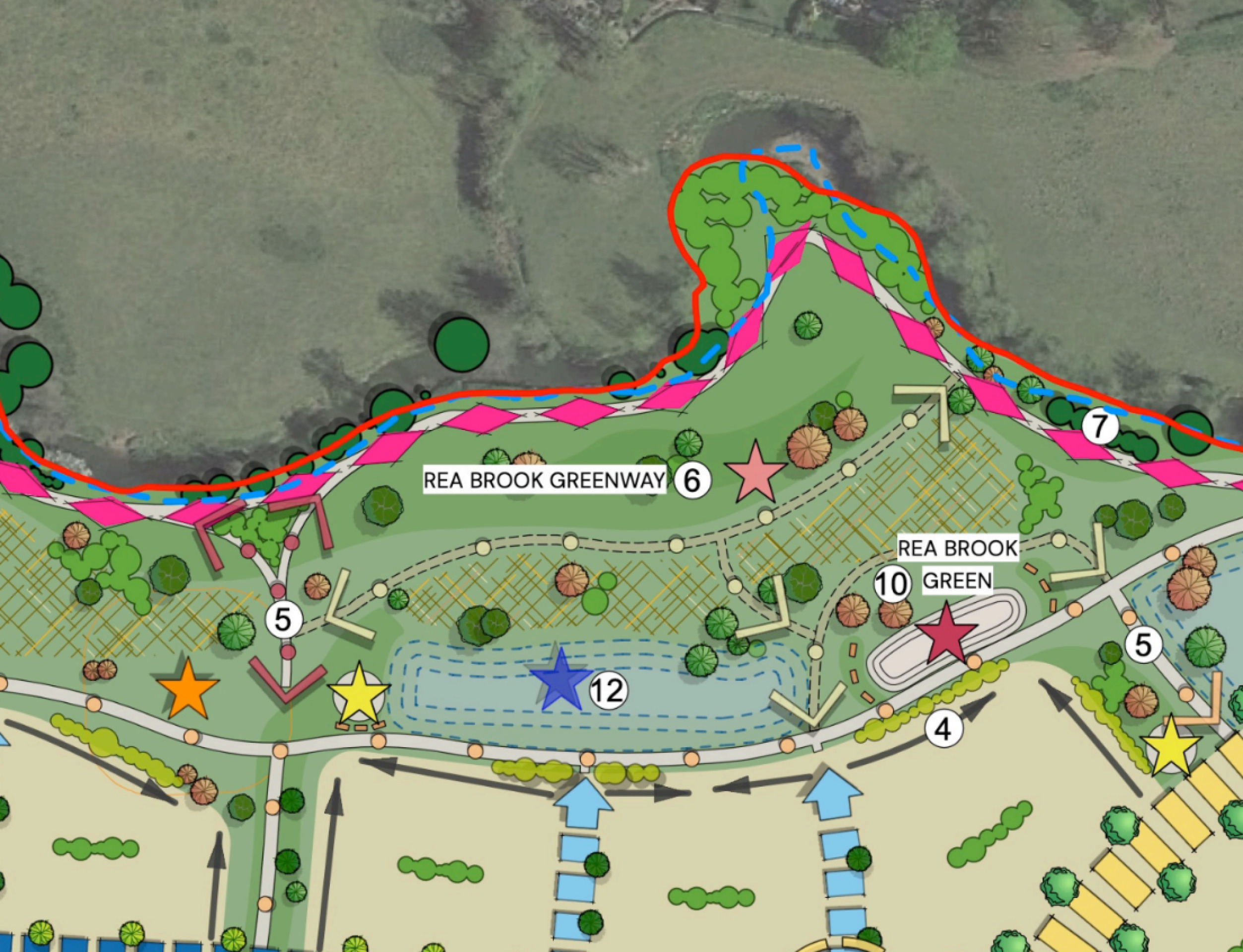
Masterplan details showing Rea Brook Greenway
Homes for Nature
Bloor Homes is a member of the Homes for Nature programme. This includes a commitment to see a bird-nesting brick or box installed for every new home built, as well as hedgehog highways as standard on every new development.

Drainage
Environment Agency flood mapping indicates that the majority of the site lies within Flood Zone 1, representing a low probability of fluvial flooding. A corridor along Rea Brook in the northern part of the site is designated as Flood Zones 2 and 3; however, this area lies outside the proposed extent of built development. Surface water flood mapping shows the site to be predominantly at very low (less than 0.1%) to low (0.1–1%) annual probability of surface water flooding.
A new surface water drainage system will be provided to serve the development. This will comprise a piped network discharging to a number of detention basins located in the lower northern area of the site. The detention basins will provide storage and control surface water discharge to greenfield runoff rates, ensuring there is no increase in flood risk on-site or downstream. They will be designed to accommodate rainfall events up to and including the 1 in 100-year storm plus 40% climate change allowance.
In addition to the detention basins, the drainage network will incorporate a range of Sustainable Drainage Systems (SuDS) such as swales, filter drains, filter strips, and permeable paving, to promote infiltration and water quality improvements. There will also be scope for the basins to provide biodiversity enhancement through the creation of wetland habitat with appropriate planting.
Foul water from the development will be conveyed via a new foul pumping station and rising main to the existing public sewer network, subject to agreement with Severn Trent Water.
The sustainable drainage system for the new neighbourhood will also provide biodiversity benefits through the provision of wetland habitat.
Heritage
A desk-based archaeological assessment has been prepared that suggests that the site has a moderate to high potential for archaeological remains for the Romano-British period noting past excavations and archaeological investigations in the surrounding area. The site is considered to have a low potential for significant archaeological remains from the medieval and post-medieval period. The full extent of the potential for archaeology will be confirmed more fully by further investigation, such as geophysical studies or trenching.
In terms of built heritage, the site contains no designated heritage assets and is not located within a Conservation Area. There is one Grade II* and 13 Grade II Listed Buildings within the wider area, as well as the Meole Brace Conservation Area, however the proposed development is not anticipated to result in a change that would impact upon the overall heritage significance of these assets.
Historic cartographic sources indicate that the site has seen a continued agricultural use from the post-medieval period onwards.
1843 Tithe Map with approximate site boundary
1902 Ordnance Survey Map, with approximate site boundary
Other technical considerations
In preparing an outline planning application for the proposed development, a full suite of technical studies is being completed, including Highways, Flooding and Drainage, Ecology, Utilities, Noise, Heritage, Contamination etc. It is not anticipated that there will be any significant technical constraints to delivering a high quality, sustainable new neighbourhood at this site.
Your feedback
Once you have reviewed the information above and viewed the concept masterplan on our interactive map, please take a moment to complete our short feedback questionnaire.